Navionics iPhone and iPad App Review
This app is just brilliant. It is a mapping and charting app by Navionics. Technically it is marine mapping, but I use it for plotting tracks on land as well. I have been told that it is the exact same maps and software that you actually get on a lot of boat depth sounders. We are spending 9 months this year at King Ash Bay Fishing Club near Borroloola in remote Northern Territory. King Ash Bay is on the banks of the McArthur River. The McArthur River System is enormous, with hundreds of creeks and tributaries running off it. It is also littered with sand bars, mud banks and rock bars. This is where the Navionics app comes in to help.
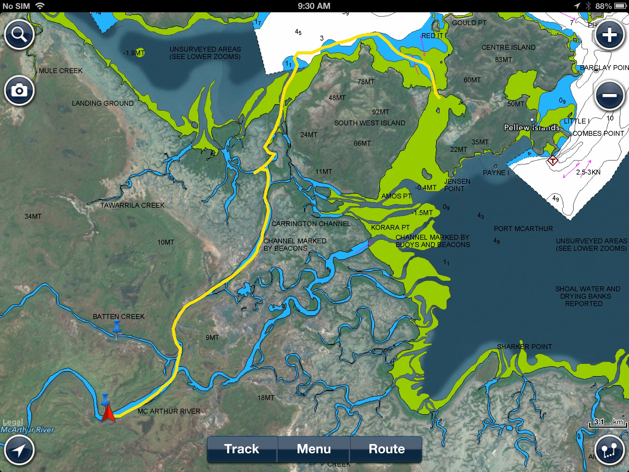
Over the past few months, every time I go out in a boat with someone who knows the local waterways, I bring my iPhone which has the Navionics app installed on it. When we leave the boat ramp, I start a new “track” recording. Using the GPS signal on the phone, Navionics will literally trace a very (very!) accurate line on the map of exactly where we have travelled. This means next time we go out by ourselves, or with someone else that doesn’t know the waterways we can safely follow the track we made. If we stay on the track, it means we will miss all the rocks, mud flats and sand bars.
But it gets better. Lets say you find a deep hole and catch some really good fish in it. You can drop a marker on that point and write some comments about it. That way there is no confusion exactly where the fishing spot is, and how good the fish were on that day. After plotting a track, the Navionics app also tells you the exact distance travelled, your average speed and also the trip duration. All very handy information when planning your next trip out on the water, or when talking to others.
Now the only downside I can see with using the iPhone for navigation is its small size, and therefore small screen size. That’s where the Navionics ipad app comes in to help. They are two separate apps. The iPhone app is about $16 and the ipad app cost me about $40 from memory. In my case I use both. This is because I don’t take my ipad with me everywhere I go. But I do take my phone. So when I’m plotting new tracks and markers, I do it on my phone. Then using the Navionics sync function, I have access to all of my information (tracks and markers etc) on both devices. That means if I am going out in the boat by myself, I might take my iPad as my navigation device because it has a much bigger screen and will be easier to read.

As I mentioned at the start of the article, I use the Navionics app not just on water, but on land as well. When exploring the outback, there are heaps of ways you can get lost when you are off the main tracks. By plotting a track, if I ever get lost, I can simply follow my track back to where I started.
A great thing to remember is this app uses the phones built in GPS and not phone signal. You do not need to have mobile phone reception for this app to tell you where you are. You only need to make sure you have the maps of the area you are traveling in or through to be downloaded.

If anyone does any serious travelling, then I would highly recommend the Navionics app. It is easy to use, not expensive, and really handy.


